


Francine

Nila81
User
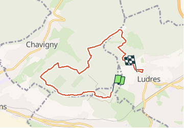

Length
7.5 km

Max alt
422 m

Uphill gradient
113 m
Km-Effort
9.3 km

Min alt
304 m

Downhill gradient
188 m
Boucle
No
Creation date :
2024-01-12 13:02:41.611
Updated on :
2024-01-12 14:58:40.118
1h54
Difficulty : Medium

FREE GPS app for hiking
 SityTrail
IGN / Geographical institutes
SityTrail Plus
The world is yours!
About
Trail Walking of 7.5 km to be discovered at Grand Est, Meurthe-et-Moselle, Messein. This trail is proposed by Nila81.
Positioning
Country:
France
Region :
Grand Est
Department/Province :
Meurthe-et-Moselle
Municipality :
Messein
Location:
Unknown
Start:(Dec)
Start:(UTM)
289877 ; 5389015 (32U) N.
Comments