


ski alternatif

Sigmut
User

Length
8.7 km

Max alt
1283 m

Uphill gradient
168 m
Km-Effort
11 km

Min alt
1164 m

Downhill gradient
205 m
Boucle
No
Creation date :
2024-01-13 12:11:55.67
Updated on :
2024-01-13 16:55:30.536
4h42
Difficulty : Very easy

FREE GPS app for hiking
 SityTrail
IGN / Geographical institutes
SityTrail Plus
The world is yours!
About
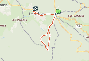
Trail Cross-country skiing of 8.7 km to be discovered at Auvergne-Rhône-Alpes, Loire, Thélis-la-Combe. This trail is proposed by Sigmut.
Photos


Positioning
Country:
France
Region :
Auvergne-Rhône-Alpes
Department/Province :
Loire
Municipality :
Thélis-la-Combe
Location:
Unknown
Start:(Dec)
Start:(UTM)
619646 ; 5024882 (31T) N.
Comments