


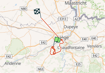
Seraing
© OpenStreetMap contributors


12h36
Difficulty : Unknown


Length
71 km
Max alt
278 m
Uphill gradient
965 m
Km-Effort
84 km
Min alt
58 m
Downhill gradient
954 m
Boucle
No
Creation date :
2024-01-14 08:26:35.0
Updated on :
2024-01-15 07:53:42.778
12h36
Difficulty : Unknown
FREE GPS app for hiking
 SityTrail
IGN / Geographical institutes
SityTrail Plus
The world is yours!
About
Trail Walking of 71 km to be discovered at Wallonia, Liège, Seraing. This trail is proposed by gabydeleu@hotmail.com.
Description
Facile mais boueux
Positioning
Country:
Belgium
Region :
Wallonia
Department/Province :
Liège
Municipality :
Seraing
Location:
Unknown
Start:(Dec)
Start:(UTM)
675600 ; 5607484 (31U) N.
Comments