


Condes

janussity
User
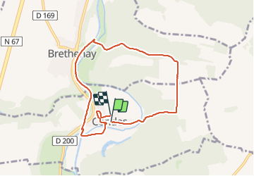

Length
7.4 km

Max alt
319 m

Uphill gradient
145 m
Km-Effort
9.3 km

Min alt
240 m

Downhill gradient
144 m
Boucle
Yes
Creation date :
2024-01-15 13:26:53.236
Updated on :
2024-01-15 15:34:14.321
1h45
Difficulty : Medium

FREE GPS app for hiking
 SityTrail
IGN / Geographical institutes
SityTrail Plus
The world is yours!
About
Trail Walking of 7.4 km to be discovered at Grand Est, Haute-Marne, Condes. This trail is proposed by janussity.
Description
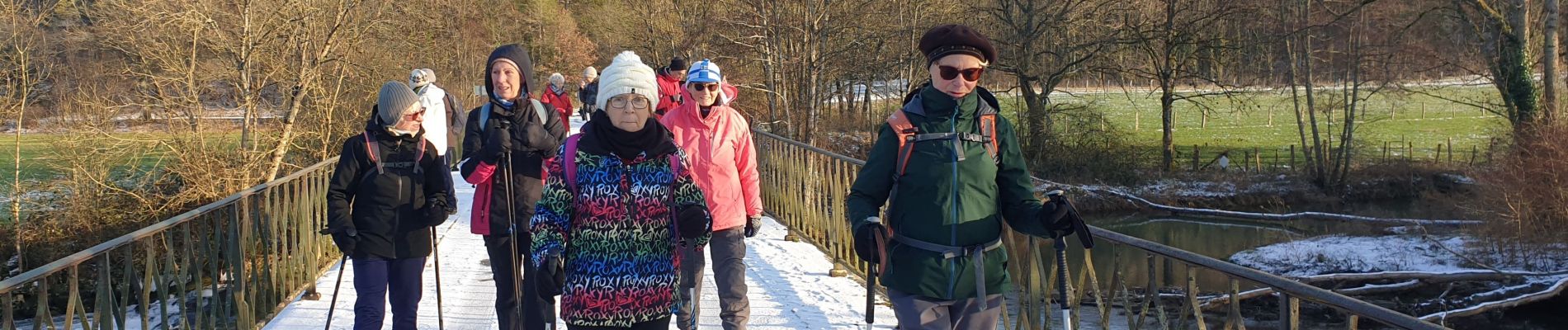
temps hivernal
Photos


Positioning
Country:
France
Region :
Grand Est
Department/Province :
Haute-Marne
Municipality :
Condes
Location:
Unknown
Start:(Dec)
Start:(UTM)
659548 ; 5334477 (31U) N.
Comments