


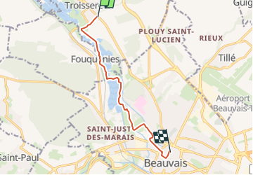
Troissereux/ Beauvais par le plan d'eau du Canada

mumu.larandonneuse
User GUIDE

Length
8 km

Max alt
82 m

Uphill gradient
42 m
Km-Effort
8.6 km

Min alt
64 m

Downhill gradient
52 m
Boucle
No
Creation date :
2024-01-18 18:36:27.004
Updated on :
2024-01-27 20:58:46.265
1h56
Difficulty : Medium

FREE GPS app for hiking
 SityTrail
IGN / Geographical institutes
SityTrail Plus
The world is yours!
About
Trail Walking of 8 km to be discovered at Hauts-de-France, Oise, Troissereux. This trail is proposed by mumu.larandonneuse.
Positioning
Country:
France
Region :
Hauts-de-France
Department/Province :
Oise
Municipality :
Troissereux
Location:
Unknown
Start:(Dec)
Start:(UTM)
431120 ; 5480905 (31U) N.
Comments