


Valvignères Le Moulinas 15km

thonyc
User GUIDE
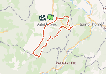

Length
15 km

Max alt
378 m

Uphill gradient
470 m
Km-Effort
21 km

Min alt
126 m

Downhill gradient
471 m
Boucle
Yes
Creation date :
2024-01-21 07:49:38.35
Updated on :
2024-01-27 22:35:46.239
4h50
Difficulty : Very difficult

FREE GPS app for hiking
 SityTrail
IGN / Geographical institutes
SityTrail Plus
The world is yours!
About
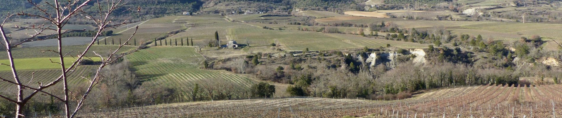
Trail Walking of 15 km to be discovered at Auvergne-Rhône-Alpes, Ardèche, Valvignères. This trail is proposed by thonyc.
Photos


Positioning
Country:
France
Region :
Auvergne-Rhône-Alpes
Department/Province :
Ardèche
Municipality :
Valvignères
Location:
Unknown
Start:(Dec)
Start:(UTM)
625146 ; 4928720 (31T) N.
Comments