


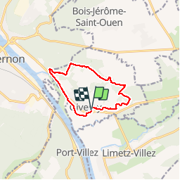
Giverny les coteaux

ymarvin27
User

Length
9.2 km

Max alt
144 m

Uphill gradient
168 m
Km-Effort
11.5 km

Min alt
13 m

Downhill gradient
170 m
Boucle
Yes
Creation date :
2015-03-05 00:00:00.0
Updated on :
2015-03-05 00:00:00.0
2h14
Difficulty : Medium

FREE GPS app for hiking
 SityTrail
IGN / Geographical institutes
SityTrail Plus
The world is yours!
About
Trail Walking of 9.2 km to be discovered at Normandy, Eure, Giverny. This trail is proposed by ymarvin27.
Description
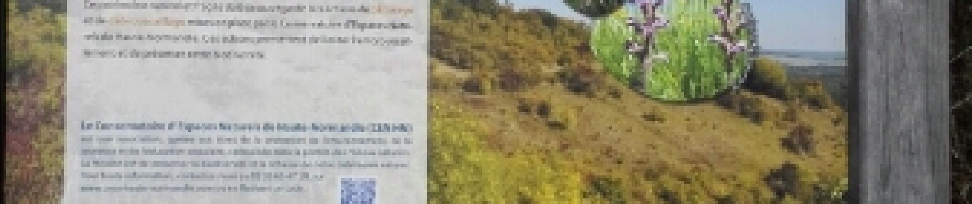
suivre le balisage jaune ou GR et la carte. 2 grandes cotes
Photos

Positioning
Country:
France
Region :
Normandy
Department/Province :
Eure
Municipality :
Giverny
Location:
Unknown
Start:(Dec)
Start:(UTM)
392663 ; 5436891 (31U) N.
Comments