


Vatel

pierrol
User

Length
30 km

Max alt
239 m

Uphill gradient
472 m
Km-Effort
36 km

Min alt
85 m

Downhill gradient
472 m
Boucle
Yes
Creation date :
2024-01-24 08:20:36.215
Updated on :
2024-01-24 08:21:20.48
2h29
Difficulty : Difficult

FREE GPS app for hiking
 SityTrail
IGN / Geographical institutes
SityTrail Plus
The world is yours!
About
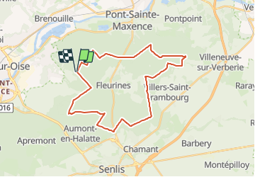
Trail Mountain bike of 30 km to be discovered at Hauts-de-France, Oise, Verneuil-en-Halatte. This trail is proposed by pierrol.
Positioning
Country:
France
Region :
Hauts-de-France
Department/Province :
Oise
Municipality :
Verneuil-en-Halatte
Location:
Unknown
Start:(Dec)
Start:(UTM)
467334 ; 5457414 (31U) N.
Comments