


20240129

Frings
User
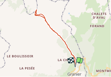

Length
14.4 km

Max alt
2236 m

Uphill gradient
878 m
Km-Effort
26 km

Min alt
1390 m

Downhill gradient
877 m
Boucle
Yes
Creation date :
2024-01-29 07:58:01.872
Updated on :
2024-01-29 14:13:07.905
3h50
Difficulty : Very easy

FREE GPS app for hiking
 SityTrail
IGN / Geographical institutes
SityTrail Plus
The world is yours!
About
Trail Touring skiing of 14.4 km to be discovered at Auvergne-Rhône-Alpes, Savoy, Aime-la-Plagne. This trail is proposed by Frings.
Positioning
Country:
France
Region :
Auvergne-Rhône-Alpes
Department/Province :
Savoy
Municipality :
Aime-la-Plagne
Location:
Granier
Start:(Dec)
Start:(UTM)
316823 ; 5049835 (32T) N.
Comments