Trail Walking Châteauneuf-d'Entraunes - Cime de l’Aspre - Photo
 bozo1970
bozo1970

User

© OpenStreetMap contributors
Length
Length
17.1 km
Max alt
Max alt
2451 m
Uphill gradient
Uphill gradient
1247 m
Km-Effort
Km-Effort  
34 km
Min alt
Min alt
1268 m
Downhill gradient
Downhill gradient
1246 m
Boucle
Boucle
Yes
Creation date :
2024-02-01 08:34:53.0
Updated on :
2024-02-02 07:26:42.911

(0 Reviews)

Walking
Walking
7h39
Difficulty : Very difficult

Scan this QR Code to open this trail in the SityTrail application

FREE GPS app for hiking

Logo SityTrail SityTrail

IGN / Geographical institutes

Download SityTrail from the App Store Download SityTrail from Google Play

Logo SityTrail SityTrail World

The world is yours!

Download SityTrail from the App Store Download SityTrail from Google Play Download SityTrail on Huawei AppGallery

About

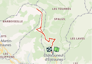
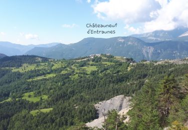
Trail Walking of 17.1 km to be discovered at Provence-Alpes-Côte d'Azur, Maritime Alps, Châteauneuf-d'Entraunes. This trail is proposed by bozo1970.

Description

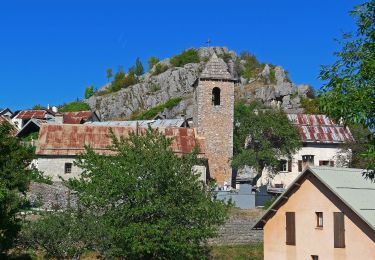
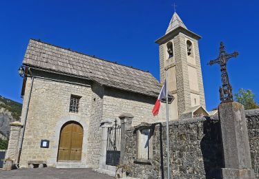
Départ de la Chapelle St Antoine
Montée par le GR 52
Balise 199 en 48’ D 366 et 2km600
Direction la Colletta
Balise 203 en 1h51’ D  728 et 5km300
Balise 212 en 2h25’ et 6km300
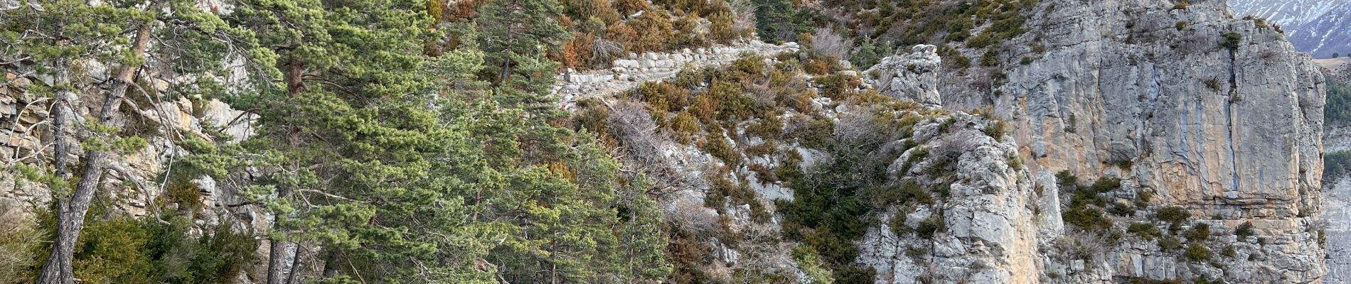
Passage en crampons
Pas de Trotte en 3h08’ D  960 et 7km460
Passage en crête jusqu’au sommet
En 4h25’ D  1323 et 9km500
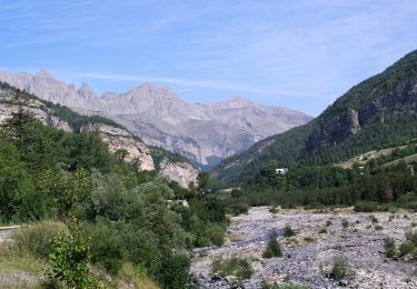
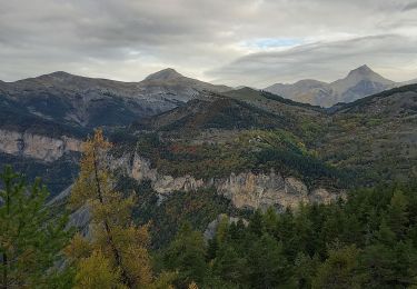
Vue exceptionnelle
Refuge tout neuf
Très sauvage
Descente en crête jusqu’à la balise 203 et retour en 6h43’ D  1404 et 17km500
Chamois

Elevation profile

Photos

26 photos in total. Please click on a photo to see them all in the gallery.

Positioning

Country:
France
Region :
Provence-Alpes-Côte d'Azur
Department/Province :
Maritime Alps
Municipality :
Châteauneuf-d'Entraunes
Location:
Unknown
Start:(UTM)
326479 ; 4888692 (32T) N.

Trails nearby

Trail On foot Villeneuve-d'Entraunes - Circuit Enaux-Sussis - Photo
On foot
PRO

On foot

Medium
Villeneuve-d'Entraunes, Provence-Alpes-Côte d'Azur, Maritime Alps, France
13.1 km | 23 km-effort
5h 8min
Yes
Trail On foot Sauze - Hameaux de Sauze - Photo
On foot
PRO

On foot

Easy
Sauze, Provence-Alpes-Côte d'Azur, Maritime Alps, France
8.8 km | 14 km-effort
3h 11min
Yes
Trail On foot Châteauneuf-d'Entraunes - Boucle de la Barlatte - Photo
On foot
PRO

On foot

Easy
Châteauneuf-d'Entraunes, Provence-Alpes-Côte d'Azur, Maritime Alps, France
6.5 km | 12.1 km-effort
2h 45min
Yes
Trail Walking Châteauneuf-d'Entraunes - Châteauneuf d'Entraunes Gorges de Saucha Negra, vers Cime Chamoussillon - Photo
Walking
GrouGary

Walking

Very easy
Châteauneuf-d'Entraunes, Provence-Alpes-Côte d'Azur, Maritime Alps, France
15.2 km | 29 km-effort
7h 2min
Yes
Trail Walking Guillaumes - Ruines de Theoulins - Photo
Walking
Marchopier

Walking

Medium
Guillaumes, Provence-Alpes-Côte d'Azur, Maritime Alps, France
16.4 km | 28 km-effort
7h 42min
Yes
Trail Walking Villeneuve-d'Entraunes - le pas Roubinous - Photo
Walking
bozo1970

Walking

Very difficult
Villeneuve-d'Entraunes, Provence-Alpes-Côte d'Azur, Maritime Alps, France
27 km | 50 km-effort
6h 40min
Yes
Trail Walking Sauze - 20190511 CAF big boucle Sauze - gorges Daluis - Photo
Walking
motardes04

Walking

Very difficult
Sauze, Provence-Alpes-Côte d'Azur, Maritime Alps, France
23 km | 40 km-effort
9h 30min
Yes
Trail Walking Guillaumes - hameaux de barels - Photo
Walking
barney06

Walking

Easy
Guillaumes, Provence-Alpes-Côte d'Azur, Maritime Alps, France
14.8 km | 23 km-effort
8h 19min
Yes
Trail Other activity Guillaumes - 3 Spéciales Guillaume  - Photo
Other activity
sophiep

Other activity

Very easy
Guillaumes, Provence-Alpes-Côte d'Azur, Maritime Alps, France
35 km | 56 km-effort
6h 22min
Yes


Close
My subscriptions