


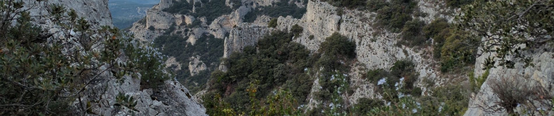
Rochers de Cairas & Onzes Heures

MarcLEBARON
User
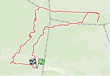

Length
14.6 km

Max alt
699 m

Uphill gradient
511 m
Km-Effort
21 km

Min alt
255 m

Downhill gradient
508 m
Boucle
Yes
Creation date :
2024-02-01 08:32:14.88
Updated on :
2024-02-02 06:36:22.831
4h02
Difficulty : Difficult

FREE GPS app for hiking
 SityTrail
IGN / Geographical institutes
SityTrail Plus
The world is yours!
About
Trail Walking of 14.6 km to be discovered at Provence-Alpes-Côte d'Azur, Vaucluse, Cheval-Blanc. This trail is proposed by MarcLEBARON.
Photos


Positioning
Country:
France
Region :
Provence-Alpes-Côte d'Azur
Department/Province :
Vaucluse
Municipality :
Cheval-Blanc
Location:
Unknown
Start:(Dec)
Start:(UTM)
676334 ; 4849135 (31T) N.
Comments