


Canche aux Merciers - Forêt de Fontaineblau

sebastienu
User
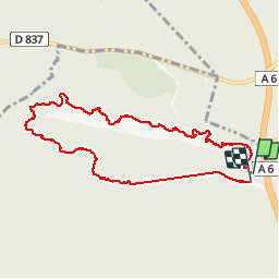

Length
8.2 km

Max alt
124 m

Uphill gradient
137 m
Km-Effort
10 km

Min alt
77 m

Downhill gradient
141 m
Boucle
Yes
Creation date :
2015-03-08 00:00:00.0
Updated on :
2015-03-08 00:00:00.0
1h42
Difficulty : Easy

FREE GPS app for hiking
 SityTrail
IGN / Geographical institutes
SityTrail Plus
The world is yours!
About
Trail Walking of 8.2 km to be discovered at Ile-de-France, Seine-et-Marne, Noisy-sur-École. This trail is proposed by sebastienu.
Positioning
Country:
France
Region :
Ile-de-France
Department/Province :
Seine-et-Marne
Municipality :
Noisy-sur-École
Location:
Unknown
Start:(Dec)
Start:(UTM)
466872 ; 5359914 (31U) N.
Comments
bravo
merci moi