Trail Walking Belgentier - Chemin de la Foux - Pas de Belgentier - Pont de la Garoute - Photo

Chemin de la Foux - Pas de Belgentier - Pont de la Garoute

 FSantoni
FSantoni

User

© OpenStreetMap contributors
Length
Length
17.2 km
Max alt
Max alt
729 m
Uphill gradient
Uphill gradient
644 m
Km-Effort
Km-Effort  
26 km
Min alt
Min alt
199 m
Downhill gradient
Downhill gradient
649 m
Boucle
Boucle
Yes
Creation date :
2024-02-02 07:59:20.508
Updated on :
2024-02-10 08:26:56.762

(1 Reviews)

Walking
Walking
5h51
Difficulty : Very difficult

Scan this QR Code to open this trail in the SityTrail application

FREE GPS app for hiking

Logo SityTrail SityTrail

IGN / Geographical institutes

Download SityTrail from the App Store Download SityTrail from Google Play

Logo SityTrail SityTrail World

The world is yours!

Download SityTrail from the App Store Download SityTrail from Google Play Download SityTrail on Huawei AppGallery

About

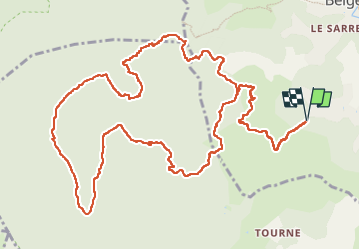
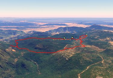
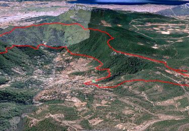
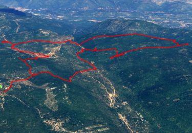
Trail Walking of 17.2 km to be discovered at Provence-Alpes-Côte d'Azur, Var, Belgentier. This trail is proposed by FSantoni.

Description

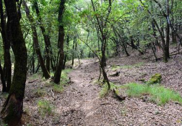
Un beau parcours de 17km avec 650 m de dénivelé en partant du chemin de la Foux, un peu avant Belgentier.
Passage par le pas de Belgentier, puis vers le pont de la Garoute.
Le tout par une journée radieuse, avec une température digne d'une mi-avril....

Elevation profile

Photos

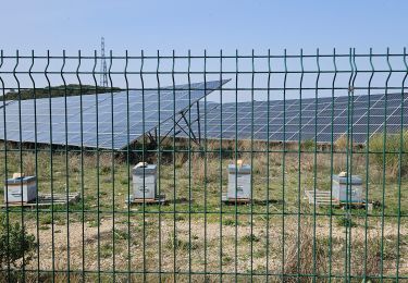
22 photos in total. Please click on a photo to see them all in the gallery.

Points of interest

Point of interest Solliès-Toucas - pique nique - Photo
FSantoni
SOLLIÈS-TOUCAS 

Positioning

Country:
France
Region :
Provence-Alpes-Côte d'Azur
Department/Province :
Var
Municipality :
Belgentier
Location:
Unknown
Start:(UTM)
742913 ; 4790700 (31T) N.

Comments

Please log in to post a review or rate the element


Trails nearby

Trail Walking Solliès-Toucas - Morières : la Garoute et la Baume des Lumes - Photo
Walking
GUIDE
affinetataille

Walking

Easy
(1)
Solliès-Toucas, Provence-Alpes-Côte d'Azur, Var, France
12.6 km | 16.7 km-effort
6h 0min
Yes
Trail Walking Solliès-Toucas - Valaury - Apier - Matheron - Photo
Walking
GUIDE
affinetataille

Walking

Medium
(1)
Solliès-Toucas, Provence-Alpes-Côte d'Azur, Var, France
13.1 km | 19.5 km-effort
5h 0min
Yes
Trail Walking Solliès-Toucas - SityTrail - siou blanc - Photo
Walking
GUIDE
affinetataille

Walking

Medium
(1)
Solliès-Toucas, Provence-Alpes-Côte d'Azur, Var, France
12.5 km | 17.4 km-effort
6h 0min
Yes
Trail Walking Méounes-lès-Montrieux - SityTrail - montrieux gapeau - Photo
Walking
GUIDE
affinetataille

Walking

Very difficult
(2)
Méounes-lès-Montrieux, Provence-Alpes-Côte d'Azur, Var, France
15.9 km | 23 km-effort
5h 14min
Yes
Trail Walking Méounes-lès-Montrieux - Chartreuse de Montreuil le jeune - Photo
Walking
martinemarie

Walking

Easy
(1)
Méounes-lès-Montrieux, Provence-Alpes-Côte d'Azur, Var, France
11.9 km | 17.1 km-effort
5h 10min
Yes
Trail Walking Solliès-Toucas - couvent St Hubert Valaury - Photo
Walking
marchev

Walking

Very easy
(2)
Solliès-Toucas, Provence-Alpes-Côte d'Azur, Var, France
12.5 km | 19.2 km-effort
4h 30min
Yes
Trail Walking Belgentier - Wikiloc - Belgentier - Photo
Walking
GUIDE
affinetataille

Walking

Medium
(1)
Belgentier, Provence-Alpes-Côte d'Azur, Var, France
10.7 km | 18.3 km-effort
5h 0min
Yes
Trail Walking Solliès-Toucas - Sioux Blanc le cou de la Marquise - Photo
Walking
martinemarie

Walking

Easy
(1)
Solliès-Toucas, Provence-Alpes-Côte d'Azur, Var, France
9.4 km | 12.6 km-effort
5h 5min
Yes
Trail Walking Belgentier - Belgentier-Barres de Cuers-Pilon St Clément - Photo
Walking
FSantoni

Walking

Very difficult
Belgentier, Provence-Alpes-Côte d'Azur, Var, France
18.8 km | 30 km-effort
6h 47min
Yes


Close
My subscriptions