


Col de Chirone et refuge de Vassieux

thonyc
User GUIDE
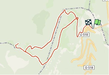

Length
13.7 km

Max alt
1544 m

Uphill gradient
583 m
Km-Effort
21 km

Min alt
1238 m

Downhill gradient
579 m
Boucle
Yes
Creation date :
2024-02-05 08:58:36.052
Updated on :
2024-02-07 09:33:51.872
4h52
Difficulty : Very difficult
0m
Difficulty : Medium

FREE GPS app for hiking
 SityTrail
IGN / Geographical institutes
SityTrail Plus
The world is yours!
About
Trail Walking of 13.7 km to be discovered at Auvergne-Rhône-Alpes, Drôme, Chamaloc. This trail is proposed by thonyc.
Description
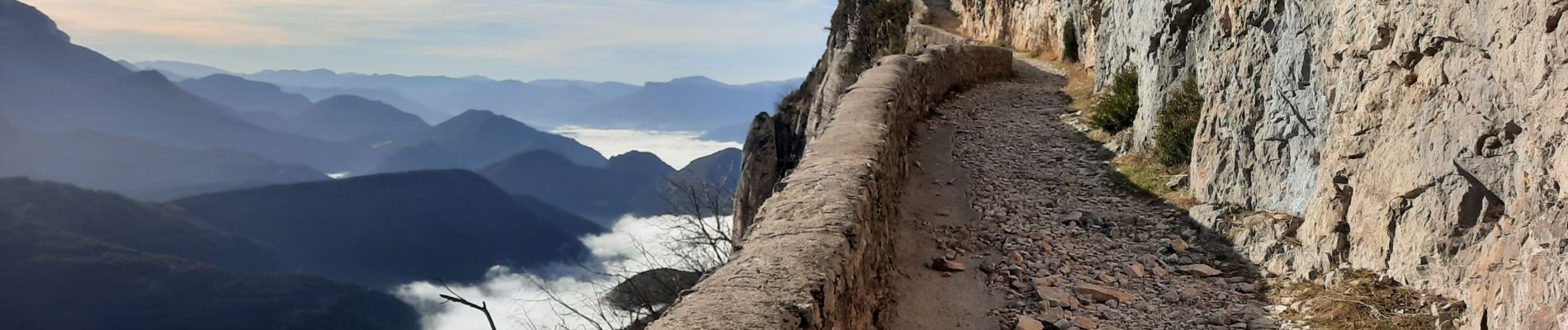
Au départ du col du Rousset, entrée sud du tunnel.
De très beaux panaoramas et une superbe montée le long de la falaise, en à-pic sur la vallée.
Photos


Positioning
Country:
France
Region :
Auvergne-Rhône-Alpes
Department/Province :
Drôme
Municipality :
Chamaloc
Location:
Unknown
Start:(Dec)
Start:(UTM)
689423 ; 4967761 (31T) N.
Comments
