


ALBENS-CROSAGNY-05-02-2024

papou73
User
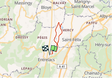

Length
8.5 km

Max alt
370 m

Uphill gradient
60 m
Km-Effort
9.3 km

Min alt
347 m

Downhill gradient
61 m
Boucle
Yes
Creation date :
2024-02-05 12:33:44.052
Updated on :
2024-02-05 15:27:48.131
2h53
Difficulty : Medium

FREE GPS app for hiking
 SityTrail
IGN / Geographical institutes
SityTrail Plus
The world is yours!
About
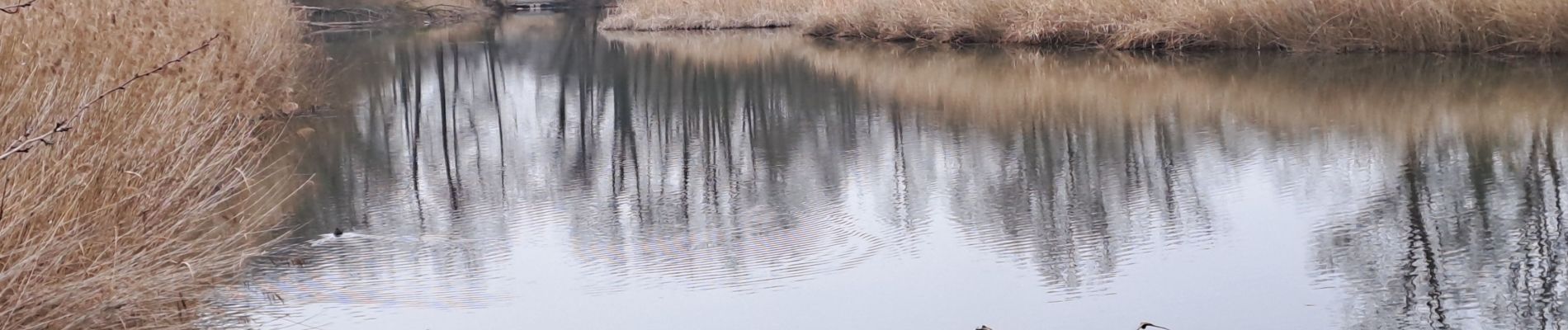
Trail Walking of 8.5 km to be discovered at Auvergne-Rhône-Alpes, Savoy, Entrelacs. This trail is proposed by papou73.
Photos


Positioning
Country:
France
Region :
Auvergne-Rhône-Alpes
Department/Province :
Savoy
Municipality :
Entrelacs
Location:
Unknown
Start:(Dec)
Start:(UTM)
729197 ; 5074814 (31T) N.
Comments