


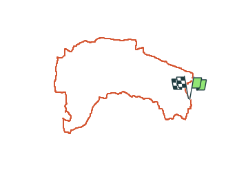
Saint marc le Blanc-Chauvigné 18,8km JY

COGLAIS3
User

Length
18.8 km

Max alt
113 m

Uphill gradient
165 m
Km-Effort
21 km

Min alt
52 m

Downhill gradient
165 m
Boucle
Yes
Creation date :
2024-02-06 07:09:40.141
Updated on :
2024-02-18 10:57:11.682
3h18
Difficulty : Easy

FREE GPS app for hiking
 SityTrail
IGN / Geographical institutes
SityTrail Plus
The world is yours!
About
Trail Nordic walking of 18.8 km to be discovered at Brittany, Ille-et-Vilaine, Saint-Marc-le-Blanc. This trail is proposed by COGLAIS3.
Positioning
Country:
France
Region :
Brittany
Department/Province :
Ille-et-Vilaine
Municipality :
Saint-Marc-le-Blanc
Location:
Saint-Marc-le-Blanc
Start:(Dec)
Start:(UTM)
617886 ; 5358341 (30U) N.
Comments