


photo

Jean-Marie J
User
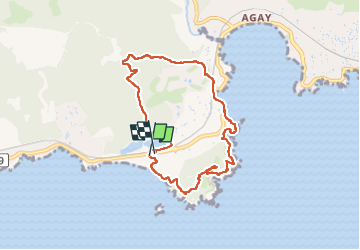

Length
8.4 km

Max alt
114 m

Uphill gradient
245 m
Km-Effort
11.7 km

Min alt
-2 m

Downhill gradient
243 m
Boucle
Yes
Creation date :
2024-02-07 07:52:06.886
Updated on :
2024-02-07 11:22:01.956
2h24
Difficulty : Medium

FREE GPS app for hiking
 SityTrail
IGN / Geographical institutes
SityTrail Plus
The world is yours!
About
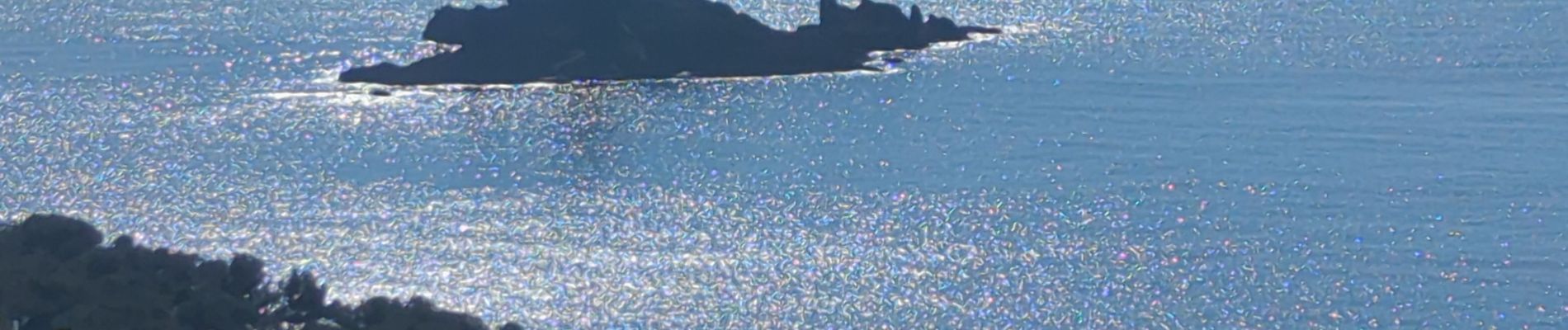
Trail Walking of 8.4 km to be discovered at Provence-Alpes-Côte d'Azur, Var, Saint-Raphaël. This trail is proposed by Jean-Marie J.
Photos


Positioning
Country:
France
Region :
Provence-Alpes-Côte d'Azur
Department/Province :
Var
Municipality :
Saint-Raphaël
Location:
Unknown
Start:(Dec)
Start:(UTM)
325529 ; 4809437 (32T) N.
Comments