


de chapelotte à rocher rambiroche

Titinechris
User
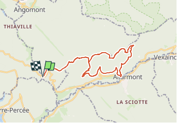

Length
16.8 km

Max alt
666 m

Uphill gradient
611 m
Km-Effort
25 km

Min alt
347 m

Downhill gradient
609 m
Boucle
Yes
Creation date :
2024-02-11 09:07:07.968
Updated on :
2024-02-11 09:08:39.559
0m
Difficulty : Easy

FREE GPS app for hiking
 SityTrail
IGN / Geographical institutes
SityTrail Plus
The world is yours!
About
Trail Trail of 16.8 km to be discovered at Grand Est, Meurthe-et-Moselle, Angomont. This trail is proposed by Titinechris.
Positioning
Country:
France
Region :
Grand Est
Department/Province :
Meurthe-et-Moselle
Municipality :
Angomont
Location:
Unknown
Start:(Dec)
Start:(UTM)
348969 ; 5372091 (32U) N.
Comments