


ST Vincent de la Commanderie N1

Monjean
User

Length
12.3 km

Max alt
746 m

Uphill gradient
505 m
Km-Effort
19 km

Min alt
328 m

Downhill gradient
505 m
Boucle
Yes
Creation date :
2024-02-01 08:24:22.625
Updated on :
2024-02-11 10:08:09.808
5h25
Difficulty : Very difficult

FREE GPS app for hiking
 SityTrail
IGN / Geographical institutes
SityTrail Plus
The world is yours!
About
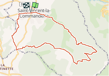
Trail Walking of 12.3 km to be discovered at Auvergne-Rhône-Alpes, Drôme, Saint-Vincent-la-Commanderie. This trail is proposed by Monjean.
Positioning
Country:
France
Region :
Auvergne-Rhône-Alpes
Department/Province :
Drôme
Municipality :
Saint-Vincent-la-Commanderie
Location:
Unknown
Start:(Dec)
Start:(UTM)
666961 ; 4978360 (31T) N.
Comments