


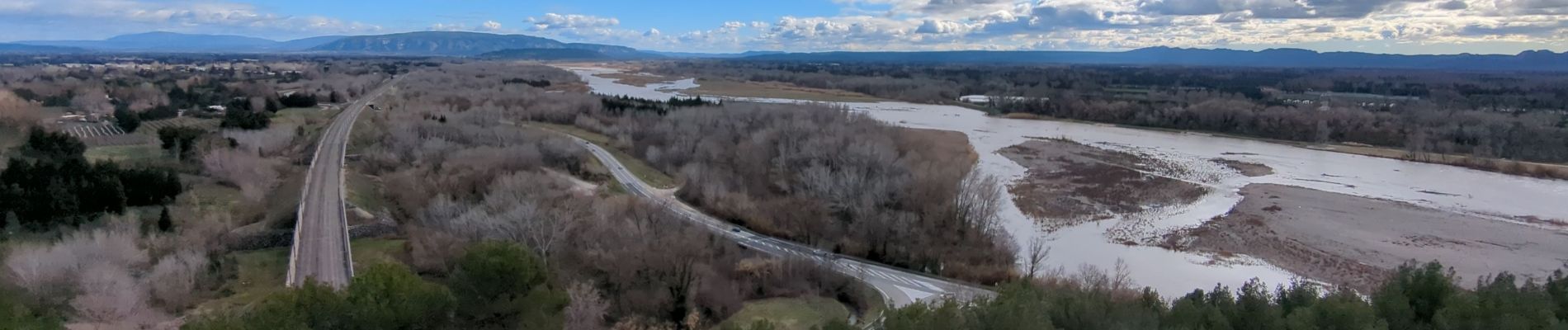
Les Hauteurs de Caumont

MarcLEBARON
User
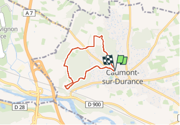

Length
5.8 km

Max alt
129 m

Uphill gradient
157 m
Km-Effort
7.8 km

Min alt
64 m

Downhill gradient
156 m
Boucle
Yes
Creation date :
2024-02-11 12:11:44.056
Updated on :
2024-02-13 11:15:48.72
1h46
Difficulty : Medium

FREE GPS app for hiking
 SityTrail
IGN / Geographical institutes
SityTrail Plus
The world is yours!
About
Trail Walking of 5.8 km to be discovered at Provence-Alpes-Côte d'Azur, Vaucluse, Caumont-sur-Durance. This trail is proposed by MarcLEBARON.
Photos


Positioning
Country:
France
Region :
Provence-Alpes-Côte d'Azur
Department/Province :
Vaucluse
Municipality :
Caumont-sur-Durance
Location:
Unknown
Start:(Dec)
Start:(UTM)
656058 ; 4862068 (31T) N.
Comments