


lac trouble

CABERMAT
User
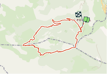

Length
10.5 km

Max alt
2402 m

Uphill gradient
886 m
Km-Effort
22 km

Min alt
1465 m

Downhill gradient
922 m
Boucle
No
Creation date :
2024-02-12 08:39:50.898
Updated on :
2024-02-13 15:21:29.332
5h16
Difficulty : Very easy

FREE GPS app for hiking
 SityTrail
IGN / Geographical institutes
SityTrail Plus
The world is yours!
About
Trail Touring skiing of 10.5 km to be discovered at Provence-Alpes-Côte d'Azur, Hautes-Alpes, Champcella. This trail is proposed by CABERMAT.
Positioning
Country:
France
Region :
Provence-Alpes-Côte d'Azur
Department/Province :
Hautes-Alpes
Municipality :
Champcella
Location:
Unknown
Start:(Dec)
Start:(UTM)
307498 ; 4953202 (32T) N.
Comments