


Ponet

raygautier
User

Length
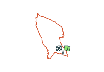
16.1 km

Max alt
1013 m

Uphill gradient
827 m
Km-Effort
27 km

Min alt
369 m

Downhill gradient
826 m
Boucle
Yes
Creation date :
2024-02-15 07:39:21.0
Updated on :
2024-02-15 15:56:24.663

FREE GPS app for hiking
 SityTrail
IGN / Geographical institutes
SityTrail Plus
The world is yours!
About
Trail of 16.1 km to be discovered at Auvergne-Rhône-Alpes, Drôme, Ponet-et-Saint-Auban. This trail is proposed by raygautier.
Positioning
Country:
France
Region :
Auvergne-Rhône-Alpes
Department/Province :
Drôme
Municipality :
Ponet-et-Saint-Auban
Location:
Unknown
Start:(Dec)
Start:(UTM)
683631 ; 4960389 (31T) N.
Comments