


Tanneron

alinetpierre
User
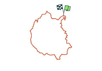

Length
9.7 km

Max alt
480 m

Uphill gradient
317 m
Km-Effort
13.9 km

Min alt
197 m

Downhill gradient
315 m
Boucle
Yes
Creation date :
2024-02-16 07:15:58.0
Updated on :
2024-02-17 07:19:30.23

FREE GPS app for hiking
 SityTrail
IGN / Geographical institutes
SityTrail Plus
The world is yours!
About
Trail of 9.7 km to be discovered at Provence-Alpes-Côte d'Azur, Var, Tanneron. This trail is proposed by alinetpierre.
Description
Randonnée sur le chemin des mimosas
Photos


Positioning
Country:
France
Region :
Provence-Alpes-Côte d'Azur
Department/Province :
Var
Municipality :
Tanneron
Location:
Unknown
Start:(Dec)
Start:(UTM)
329196 ; 4827160 (32T) N.
Comments