


entre Wonck et Eben-Eser

stef789
User GUIDE
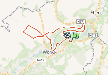

Length
8 km

Max alt
126 m

Uphill gradient
110 m
Km-Effort
9.5 km

Min alt
64 m

Downhill gradient
111 m
Boucle
Yes
Creation date :
2024-02-18 13:18:47.31
Updated on :
2024-02-18 15:18:00.094
1h59
Difficulty : Easy

FREE GPS app for hiking
 SityTrail
IGN / Geographical institutes
SityTrail Plus
The world is yours!
About
Trail Walking of 8 km to be discovered at Wallonia, Liège, Bassenge. This trail is proposed by stef789.
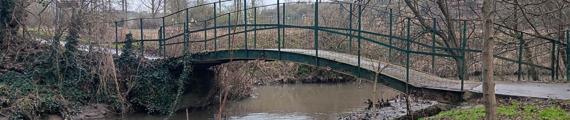
Photos


Positioning
Country:
Belgium
Region :
Wallonia
Department/Province :
Liège
Municipality :
Bassenge
Location:
Unknown
Start:(Dec)
Start:(UTM)
686575 ; 5627713 (31U) N.
Comments