


Aumont_Poteau d_Auteuil_Trace GPS simplifiée_10.1km

Pousscailleux
User

Length
9.8 km

Max alt
147 m

Uphill gradient
129 m
Km-Effort
11.5 km

Min alt
85 m

Downhill gradient
129 m
Boucle
Yes
Creation date :
2015-03-14 00:00:00.0
Updated on :
2015-03-14 00:00:00.0
2h51
Difficulty : Difficult

FREE GPS app for hiking
 SityTrail
IGN / Geographical institutes
SityTrail Plus
The world is yours!
About
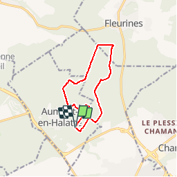
Trail Walking of 9.8 km to be discovered at Hauts-de-France, Oise, Aumont-en-Halatte. This trail is proposed by Pousscailleux.
Description
Départ du carrefour de la Queue de la Brosse.
Beaucoup de sentiers très boueux, défoncés par les forestiers, à la limite du praticable.
Positioning
Country:
France
Region :
Hauts-de-France
Department/Province :
Oise
Municipality :
Aumont-en-Halatte
Location:
Unknown
Start:(Dec)
Start:(UTM)
468125 ; 5452670 (31U) N.
Comments