


Aumont en Halatte_mare du mont Alta_Trace GPS simplifiée_8,7km

Pousscailleux
User
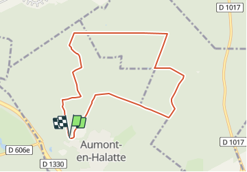

Length
8.7 km

Max alt
148 m

Uphill gradient
137 m
Km-Effort
10.5 km

Min alt
104 m

Downhill gradient
140 m
Boucle
Yes
Creation date :
2015-03-14 00:00:00.0
Updated on :
2015-03-14 00:00:00.0
2h18
Difficulty : Difficult

FREE GPS app for hiking
 SityTrail
IGN / Geographical institutes
SityTrail Plus
The world is yours!
About
Trail Walking of 8.7 km to be discovered at Hauts-de-France, Oise, Aumont-en-Halatte. This trail is proposed by Pousscailleux.
Description
Départ du parking de l'ancienne carrière à l'entrée d'Aumont.
Beaucoup de sentiers défoncés, à la limite du praticable.
Positioning
Country:
France
Region :
Hauts-de-France
Department/Province :
Oise
Municipality :
Aumont-en-Halatte
Location:
Unknown
Start:(Dec)
Start:(UTM)
466965 ; 5453286 (31U) N.
Comments