


puig pedros

stef789
User GUIDE
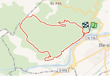

Length
11.7 km

Max alt
376 m

Uphill gradient
288 m
Km-Effort
15.6 km

Min alt
142 m

Downhill gradient
286 m
Boucle
Yes
Creation date :
2024-02-28 12:28:30.65
Updated on :
2024-02-28 16:26:29.481
3h57
Difficulty : Medium

FREE GPS app for hiking
 SityTrail
IGN / Geographical institutes
SityTrail Plus
The world is yours!
About
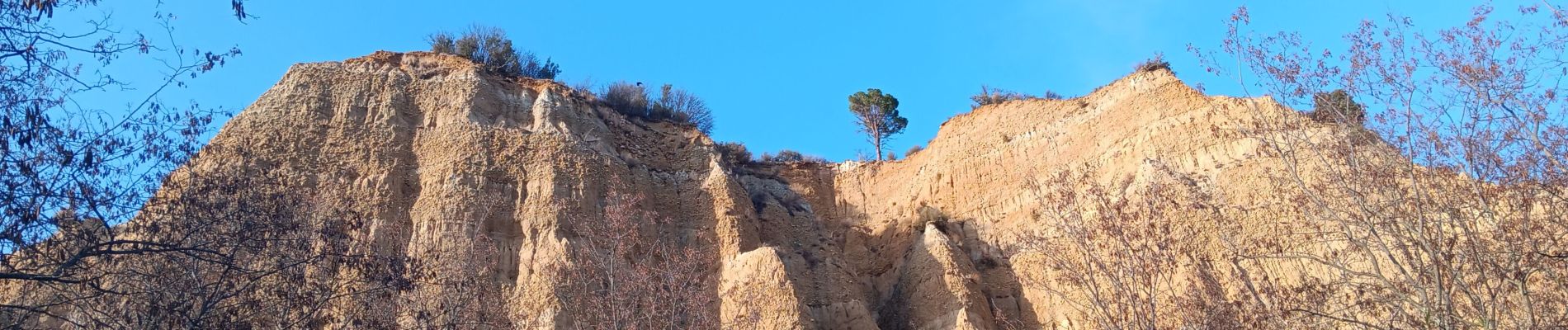
Trail Walking of 11.7 km to be discovered at Occitania, Pyrénées-Orientales, Ille-sur-Têt. This trail is proposed by stef789.
Photos


34 photos in total. Please click on a photo to see them all in the gallery.
Positioning
Country:
France
Region :
Occitania
Department/Province :
Pyrénées-Orientales
Municipality :
Ille-sur-Têt
Location:
Unknown
Start:(Dec)
Start:(UTM)
468132 ; 4724955 (31T) N.
Comments