


1

fra_depoorter
User
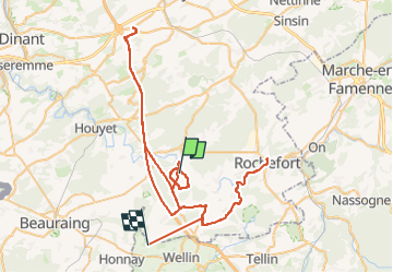

Length
92 km

Max alt
310 m

Uphill gradient
1460 m
Km-Effort
111 km

Min alt
134 m

Downhill gradient
1369 m
Boucle
No
Creation date :
2024-02-29 13:00:03.891
Updated on :
2024-03-02 09:00:02.159
41h51
Difficulty : Very difficult

FREE GPS app for hiking
 SityTrail
IGN / Geographical institutes
SityTrail Plus
The world is yours!
About
Trail Walking of 92 km to be discovered at Wallonia, Namur, Rochefort. This trail is proposed by fra_depoorter.
Positioning
Country:
Belgium
Region :
Wallonia
Department/Province :
Namur
Municipality :
Rochefort
Location:
Villers-sur-Lesse
Start:(Dec)
Start:(UTM)
650851 ; 5557548 (31U) N.
Comments