


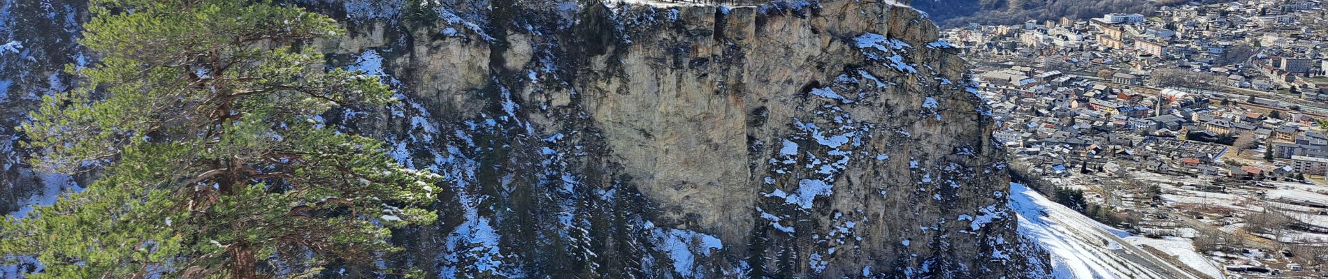
Sentier de la forêt d'Erica

micheldutilleul
User
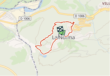

Length
2.8 km

Max alt
1417 m

Uphill gradient
98 m
Km-Effort
4.1 km

Min alt
1327 m

Downhill gradient
106 m
Boucle
Yes
Creation date :
2024-03-04 13:29:19.762
Updated on :
2024-03-04 17:00:54.392
1h25
Difficulty : Easy

FREE GPS app for hiking
 SityTrail
IGN / Geographical institutes
SityTrail Plus
The world is yours!
About
Trail Walking of 2.8 km to be discovered at Auvergne-Rhône-Alpes, Savoy, Villarodin-Bourget. This trail is proposed by micheldutilleul.
Photos


Positioning
Country:
France
Region :
Auvergne-Rhône-Alpes
Department/Province :
Savoy
Municipality :
Villarodin-Bourget
Location:
Unknown
Start:(Dec)
Start:(UTM)
319006 ; 5007872 (32T) N.
Comments