


Saisy-Autun

GUERLACH
User

Length
23 km

Max alt
549 m

Uphill gradient
404 m
Km-Effort
29 km

Min alt
297 m

Downhill gradient
485 m
Boucle
No
Creation date :
2015-03-19 00:00:00.0
Updated on :
2019-05-06 18:11:13.853
6h00
Difficulty : Medium

FREE GPS app for hiking
 SityTrail
IGN / Geographical institutes
SityTrail Plus
The world is yours!
About
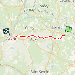
Trail Walking of 23 km to be discovered at Bourgogne-Franche-Comté, Saône-et-Loire, Saisy. This trail is proposed by GUERLACH.
Description
Départ de l’Église de Saisy vers Autun, en passant les bois et les prés.
Positioning
Country:
France
Region :
Bourgogne-Franche-Comté
Department/Province :
Saône-et-Loire
Municipality :
Saisy
Location:
Unknown
Start:(Dec)
Start:(UTM)
617767 ; 5201923 (31T) N.
Comments