


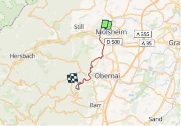
Mutzig - Mont Sainte Odile

Titinechris
User

Length
19.3 km

Max alt
773 m

Uphill gradient
808 m
Km-Effort
28 km

Min alt
186 m

Downhill gradient
229 m
Boucle
No
Creation date :
2024-03-05 16:49:38.48
Updated on :
2024-03-05 16:50:47.172
6h23
Difficulty : Very difficult

FREE GPS app for hiking
 SityTrail
IGN / Geographical institutes
SityTrail Plus
The world is yours!
About
Trail Walking of 19.3 km to be discovered at Grand Est, Bas-Rhin, Mutzig. This trail is proposed by Titinechris.
Description
visite de Rosheim, Boersch, Otrott
Positioning
Country:
France
Region :
Grand Est
Department/Province :
Bas-Rhin
Municipality :
Mutzig
Location:
Unknown
Start:(Dec)
Start:(UTM)
386414 ; 5376779 (32U) N.
Comments