


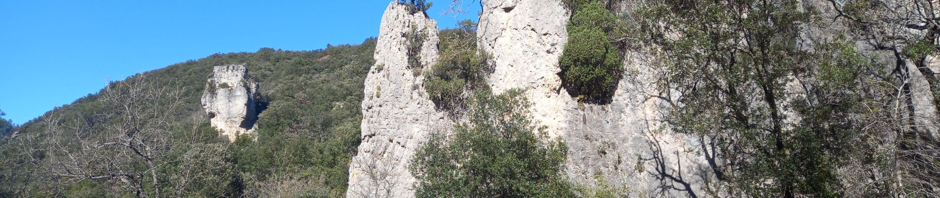
Aiguilles de Valbelle

Pascal-83
User
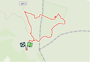

Length
10.2 km

Max alt
646 m

Uphill gradient
279 m
Km-Effort
14 km

Min alt
437 m

Downhill gradient
278 m
Boucle
Yes
Creation date :
2024-03-05 09:53:58.733
Updated on :
2024-03-05 18:21:42.431
4h09
Difficulty : Medium

FREE GPS app for hiking
 SityTrail
IGN / Geographical institutes
SityTrail Plus
The world is yours!
About
Trail Walking of 10.2 km to be discovered at Provence-Alpes-Côte d'Azur, Var, Signes. This trail is proposed by Pascal-83.
Photos


Positioning
Country:
France
Region :
Provence-Alpes-Côte d'Azur
Department/Province :
Var
Municipality :
Signes
Location:
Unknown
Start:(Dec)
Start:(UTM)
737158 ; 4790540 (31T) N.
Comments