


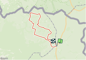
Rocher de Bieley (Rocherath) 12Km

Efr
User

Length
12 km

Max alt
624 m

Uphill gradient
222 m
Km-Effort
14.9 km

Min alt
526 m

Downhill gradient
222 m
Boucle
Yes
Creation date :
2024-03-08 22:01:10.191
Updated on :
2024-04-01 15:40:46.728
3h23
Difficulty : Difficult

FREE GPS app for hiking
 SityTrail
IGN / Geographical institutes
SityTrail Plus
The world is yours!
About
Trail Walking of 12 km to be discovered at Wallonia, Liège, Büllingen. This trail is proposed by Efr.
Description
Depart: Rocherath(4761)
Rocheratherstrasse ( N658)
Positioning
Country:
Belgium
Region :
Wallonia
Department/Province :
Liège
Municipality :
Büllingen
Location:
Unknown
Start:(Dec)
Start:(UTM)
308550 ; 5594162 (32U) N.
Comments