


test

FLF67
User
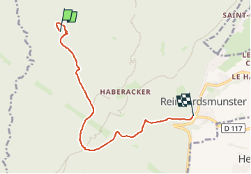

Length
5.6 km

Max alt
528 m

Uphill gradient
80 m
Km-Effort
7.1 km

Min alt
355 m

Downhill gradient
237 m
Boucle
No
Creation date :
2023-12-30 09:17:04.989
Updated on :
2024-03-09 16:42:13.219
1152h09
Difficulty : Medium

FREE GPS app for hiking
 SityTrail
IGN / Geographical institutes
SityTrail Plus
The world is yours!
About
Trail Walking of 5.6 km to be discovered at Grand Est, Bas-Rhin, Reinhardsmunster. This trail is proposed by FLF67.
Positioning
Country:
France
Region :
Grand Est
Department/Province :
Bas-Rhin
Municipality :
Reinhardsmunster
Location:
Unknown
Start:(Dec)
Start:(UTM)
373607 ; 5394184 (32U) N.
Comments