


Vinay -Bac de Treillins

crocau
User
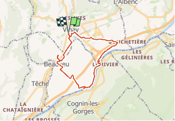

Length
13.9 km

Max alt
291 m

Uphill gradient
175 m
Km-Effort
16.2 km

Min alt
175 m

Downhill gradient
176 m
Boucle
Yes
Creation date :
2024-03-10 15:56:47.618
Updated on :
2024-03-10 18:05:29.131
2h08
Difficulty : Easy

FREE GPS app for hiking
 SityTrail
IGN / Geographical institutes
SityTrail Plus
The world is yours!
About
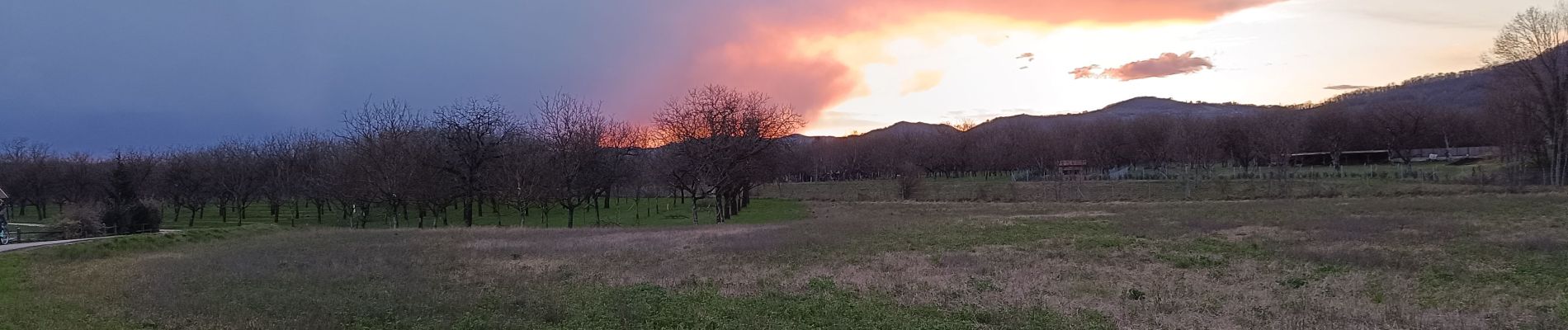
Trail Mountain bike of 13.9 km to be discovered at Auvergne-Rhône-Alpes, Isère, Vinay. This trail is proposed by crocau.
Photos


Positioning
Country:
France
Region :
Auvergne-Rhône-Alpes
Department/Province :
Isère
Municipality :
Vinay
Location:
Unknown
Start:(Dec)
Start:(UTM)
688526 ; 5008877 (31T) N.
Comments