


2024-03-15_09h24m28_Ria___Llugols___Sant_Cristofol___Pas_de_l_Esacala___Belloc___Conat

jeanic63
User
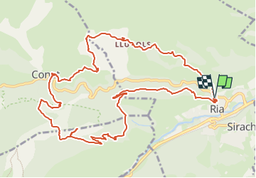


5h45
Difficulty : Medium

FREE GPS app for hiking
 SityTrail
IGN / Geographical institutes
SityTrail Plus
The world is yours!
About
Trail On foot of 14.8 km to be discovered at Occitania, Pyrénées-Orientales, Ria-Sirach. This trail is proposed by jeanic63.
Description
départ Ria ,(en venant de Perpignan à la sortie de Prades tourner à droite direction Ria Sirach ,dans le village de Ria prendre la direction Conat puis après les dernières maisons tourner à gauche voie sans issue qui va au paking
Positioning
Comments