


Louroux a/r par Doussa 17 03 24

RenaudCandottiBesson
User
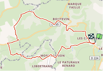

Length
13 km

Max alt
501 m

Uphill gradient
291 m
Km-Effort
16.9 km

Min alt
391 m

Downhill gradient
291 m
Boucle
Yes
Creation date :
2024-03-17 13:12:32.898
Updated on :
2024-03-17 16:43:13.216
2h55
Difficulty : Difficult

FREE GPS app for hiking
 SityTrail
IGN / Geographical institutes
SityTrail Plus
The world is yours!
About
Trail Walking of 13 km to be discovered at Auvergne-Rhône-Alpes, Allier, Louroux-de-Bouble. This trail is proposed by RenaudCandottiBesson.
Positioning
Country:
France
Region :
Auvergne-Rhône-Alpes
Department/Province :
Allier
Municipality :
Louroux-de-Bouble
Location:
Unknown
Start:(Dec)
Start:(UTM)
498479 ; 5119159 (31T) N.
Comments