2024 - Oberkirch Brennersteig

dragonfr67
User
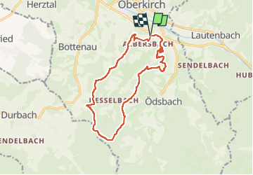

Length
14 km

Max alt
486 m

Uphill gradient
472 m
Km-Effort
20 km

Min alt
196 m

Downhill gradient
469 m
Boucle
Yes
Creation date :
2024-03-17 09:06:33.422
Updated on :
2024-03-17 21:14:54.711
4h36
Difficulty : Very difficult

FREE GPS app for hiking
 SityTrail
IGN / Geographical institutes
SityTrail Plus
The world is yours!
About
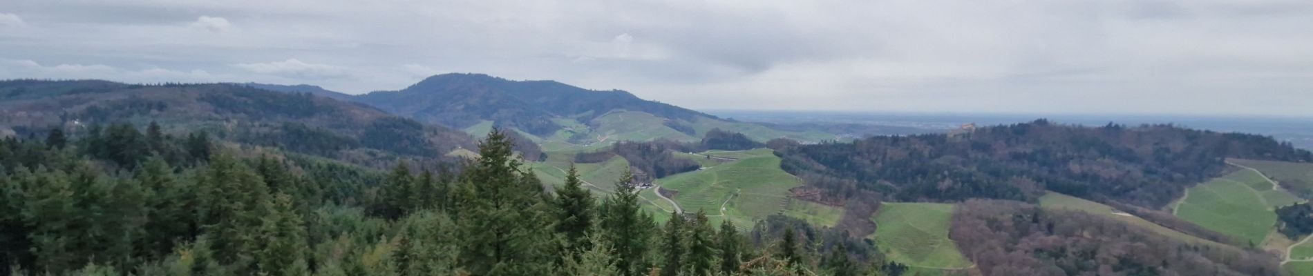
Trail Walking of 14 km to be discovered at Baden-Württemberg, Ortenaukreis, Oberkirch. This trail is proposed by dragonfr67.
Description
Très belle randonnées sur le chemin des brûleurs d'eau de vie.
Beaucoup de lieu pour pique niquer et boire des snaps :-)
Photos


Positioning
Country:
Germany
Region :
Baden-Württemberg
Department/Province :
Ortenaukreis
Municipality :
Oberkirch
Location:
Unknown
Start:(Dec)
Start:(UTM)
432290 ; 5374543 (32U) N.
Comments