


Neige

raygautier
User
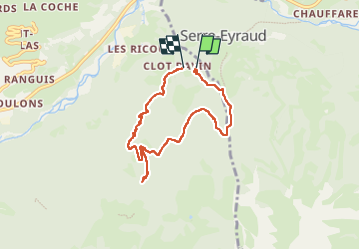

Length
6.9 km

Max alt
1754 m

Uphill gradient
371 m
Km-Effort
11.9 km

Min alt
1358 m

Downhill gradient
407 m
Boucle
Yes
Creation date :
2024-03-18 10:16:41.0
Updated on :
2024-03-18 16:11:52.874

FREE GPS app for hiking
 SityTrail
IGN / Geographical institutes
SityTrail Plus
The world is yours!
About
Trail of 6.9 km to be discovered at Provence-Alpes-Côte d'Azur, Hautes-Alpes, Saint-Jean-Saint-Nicolas. This trail is proposed by raygautier.
Positioning
Country:
France
Region :
Provence-Alpes-Côte d'Azur
Department/Province :
Hautes-Alpes
Municipality :
Saint-Jean-Saint-Nicolas
Location:
Unknown
Start:(Dec)
Start:(UTM)
283666 ; 4950475 (32T) N.
Comments