


Crête Charlemagne

PhilippeC54
User

Length
10.9 km

Max alt
396 m

Uphill gradient
200 m
Km-Effort
13.6 km

Min alt
303 m

Downhill gradient
199 m
Boucle
No
Creation date :
2024-03-19 13:15:29.588
Updated on :
2024-03-19 15:56:09.048
2h29
Difficulty : Easy

FREE GPS app for hiking
 SityTrail
IGN / Geographical institutes
SityTrail Plus
The world is yours!
About
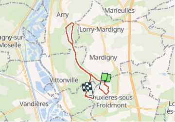
Trail Walking of 10.9 km to be discovered at Grand Est, Meurthe-et-Moselle, Bouxières-sous-Froidmont. This trail is proposed by PhilippeC54.
Positioning
Country:
France
Region :
Grand Est
Department/Province :
Meurthe-et-Moselle
Municipality :
Bouxières-sous-Froidmont
Location:
Unknown
Start:(Dec)
Start:(UTM)
286514 ; 5427286 (32U) N.
Comments