


20240319-Mauny

doudet
User

Length
12.8 km

Max alt
143 m

Uphill gradient
271 m
Km-Effort
16.4 km

Min alt
3 m

Downhill gradient
272 m
Boucle
Yes
Creation date :
2024-03-19 12:57:35.642
Updated on :
2024-03-24 10:04:58.016
3h53
Difficulty : Difficult

FREE GPS app for hiking
 SityTrail
IGN / Geographical institutes
SityTrail Plus
The world is yours!
About
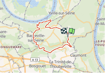
Trail Walking of 12.8 km to be discovered at Normandy, Seine-Maritime, Mauny. This trail is proposed by doudet.
Description
Boucle A-R au départ de la Mairie
Positioning
Country:
France
Region :
Normandy
Department/Province :
Seine-Maritime
Municipality :
Mauny
Location:
Unknown
Start:(Dec)
Start:(UTM)
346536 ; 5471882 (31U) N.
Comments