


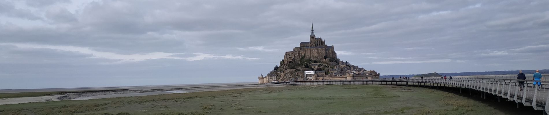
2020-03-19 mont saint Michel

jacq58
User
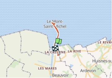

Length
6.5 km

Max alt
47 m

Uphill gradient
73 m
Km-Effort
7.5 km

Min alt
0 m

Downhill gradient
75 m
Boucle
No
Creation date :
2024-03-19 12:24:00.566
Updated on :
2024-03-20 07:02:04.098
1h02
Difficulty : Medium

FREE GPS app for hiking
 SityTrail
IGN / Geographical institutes
SityTrail Plus
The world is yours!
About
Trail Walking of 6.5 km to be discovered at Normandy, Manche, Pontorson. This trail is proposed by jacq58.
Photos


Positioning
Country:
France
Region :
Normandy
Department/Province :
Manche
Municipality :
Pontorson
Location:
Pontorson
Start:(Dec)
Start:(UTM)
609747 ; 5386036 (30U) N.
Comments