


doyet malicorne

Guy Laurent
User
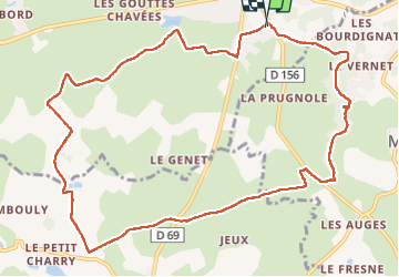

Length
12.5 km

Max alt
394 m

Uphill gradient
134 m
Km-Effort
14.3 km

Min alt
288 m

Downhill gradient
135 m
Boucle
Yes
Creation date :
2024-03-20 08:02:53.496
Updated on :
2024-03-20 11:15:24.331
3h12
Difficulty : Difficult

FREE GPS app for hiking
 SityTrail
IGN / Geographical institutes
SityTrail Plus
The world is yours!
About
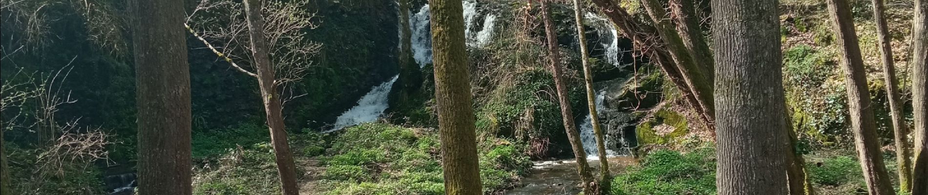
Trail Walking of 12.5 km to be discovered at Auvergne-Rhône-Alpes, Allier, Doyet. This trail is proposed by Guy Laurent.
Photos

Positioning
Country:
France
Region :
Auvergne-Rhône-Alpes
Department/Province :
Allier
Municipality :
Doyet
Location:
Unknown
Start:(Dec)
Start:(UTM)
484616 ; 5131001 (31T) N.
Comments