


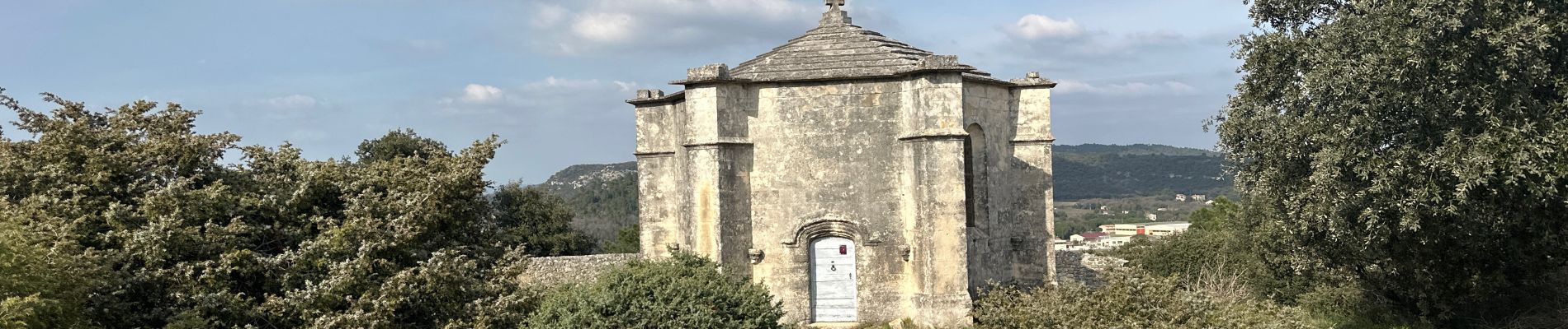
St Restitut, Chabrieres, le Barry

alinetpierre
User
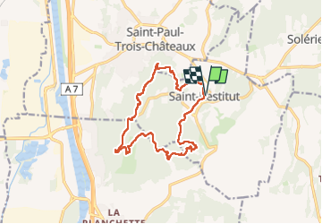

Length
15.2 km

Max alt
283 m

Uphill gradient
429 m
Km-Effort
21 km

Min alt
134 m

Downhill gradient
428 m
Boucle
Yes
Creation date :
2024-03-20 08:24:56.0
Updated on :
2024-03-20 15:11:46.407

FREE GPS app for hiking
 SityTrail
IGN / Geographical institutes
SityTrail Plus
The world is yours!
About
Trail of 15.2 km to be discovered at Auvergne-Rhône-Alpes, Drôme, Saint-Restitut. This trail is proposed by alinetpierre.
Description
Boucle autour de St Restitut, azur
Photos


Positioning
Country:
France
Region :
Auvergne-Rhône-Alpes
Department/Province :
Drôme
Municipality :
Saint-Restitut
Location:
Unknown
Start:(Dec)
Start:(UTM)
642732 ; 4910290 (31T) N.
Comments