


Vinay-Cognin-Izeron

crocau
User
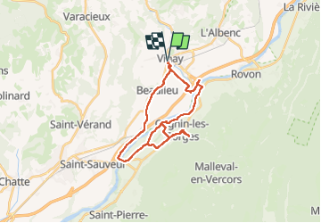

Length
28 km

Max alt
348 m

Uphill gradient
409 m
Km-Effort
33 km

Min alt
185 m

Downhill gradient
409 m
Boucle
Yes
Creation date :
2024-03-21 10:48:34.79
Updated on :
2024-03-21 14:20:33.267
2h29
Difficulty : Easy

FREE GPS app for hiking
 SityTrail
IGN / Geographical institutes
SityTrail Plus
The world is yours!
About
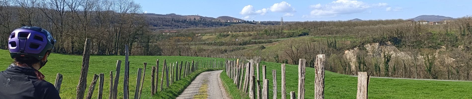
Trail Mountain bike of 28 km to be discovered at Auvergne-Rhône-Alpes, Isère, Vinay. This trail is proposed by crocau.
Photos


Positioning
Country:
France
Region :
Auvergne-Rhône-Alpes
Department/Province :
Isère
Municipality :
Vinay
Location:
Unknown
Start:(Dec)
Start:(UTM)
688497 ; 5008877 (31T) N.
Comments