


Cholera

CDSM 55
User

Length
79 m

Max alt
385 m

Uphill gradient
0 m
Km-Effort
79 m

Min alt
382 m

Downhill gradient
0 m
Boucle
No
Creation date :
2024-03-24 14:25:38.547
Updated on :
2024-03-24 14:58:42.503
1m
Difficulty : Easy

FREE GPS app for hiking
 SityTrail
IGN / Geographical institutes
SityTrail Plus
The world is yours!
About
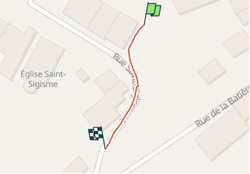
Trail Walking of 79 m to be discovered at Grand Est, Meuse, Vouthon-Haut. This trail is proposed by CDSM 55.
Positioning
Country:
France
Region :
Grand Est
Department/Province :
Meuse
Municipality :
Vouthon-Haut
Location:
Unknown
Start:(Dec)
Start:(UTM)
693510 ; 5372539 (31U) N.
Comments