


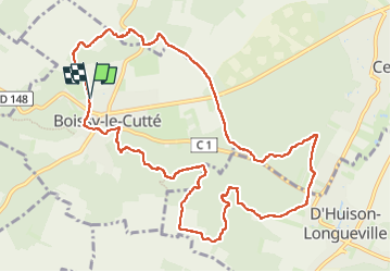
2024-03-25 Rando Boissy le Cuté

jchezlemas
User

Length
12 km

Max alt
152 m

Uphill gradient
192 m
Km-Effort
14.6 km

Min alt
65 m

Downhill gradient
189 m
Boucle
Yes
Creation date :
2024-03-25 08:13:18.073
Updated on :
2024-03-25 13:47:21.664
2h55
Difficulty : Easy

FREE GPS app for hiking
 SityTrail
IGN / Geographical institutes
SityTrail Plus
The world is yours!
About
Trail Walking of 12 km to be discovered at Ile-de-France, Essonne, Boissy-le-Cutté. This trail is proposed by jchezlemas.
Description
Rando de Martine et Alain Gauthier
Office de Tourisme de l'Arpajonnais
https://www.ot-coeuressonne.fr/
Positioning
Country:
France
Region :
Ile-de-France
Department/Province :
Essonne
Municipality :
Boissy-le-Cutté
Location:
Unknown
Start:(Dec)
Start:(UTM)
446904 ; 5369108 (31U) N.
Comments