


Paziols boucle

robertperello
User
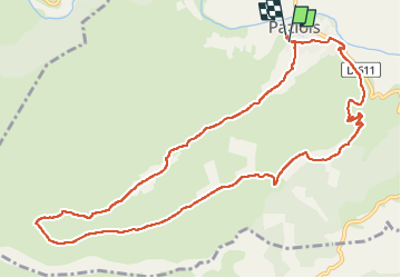

Length
12.7 km

Max alt
400 m

Uphill gradient
308 m
Km-Effort
16.8 km

Min alt
131 m

Downhill gradient
307 m
Boucle
Yes
Creation date :
2024-03-27 08:52:02.0
Updated on :
2024-03-27 13:29:59.971
3h13
Difficulty : Easy

FREE GPS app for hiking
 SityTrail
IGN / Geographical institutes
SityTrail Plus
The world is yours!
About
Trail Walking of 12.7 km to be discovered at Occitania, Aude, Paziols. This trail is proposed by robertperello.
Description
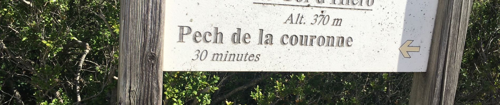
Rando sur un plateau et sur piste
Photos

Positioning
Country:
France
Region :
Occitania
Department/Province :
Aude
Municipality :
Paziols
Location:
Unknown
Start:(Dec)
Start:(UTM)
476946 ; 4745022 (31T) N.
Comments