Trail Walking Drachenbronn-Birlenbach - Tour du Birlenbach - Photo
 LUTZMarc
LUTZMarc

User

© OpenStreetMap contributors
Length
Length
17.1 km
Max alt
Max alt
214 m
Uphill gradient
Uphill gradient
223 m
Km-Effort
Km-Effort  
20 km
Min alt
Min alt
144 m
Downhill gradient
Downhill gradient
218 m
Boucle
Boucle
Yes
Creation date :
2024-03-28 08:09:02.276
Updated on :
2024-03-28 14:25:29.75

(0 Reviews)

Walking
Walking
3h54
Difficulty : Easy

Scan this QR Code to open this trail in the SityTrail application

FREE GPS app for hiking

Logo SityTrail SityTrail

IGN / Geographical institutes

Download SityTrail from the App Store Download SityTrail from Google Play

Logo SityTrail SityTrail World

The world is yours!

Download SityTrail from the App Store Download SityTrail from Google Play Download SityTrail on Huawei AppGallery

About

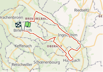
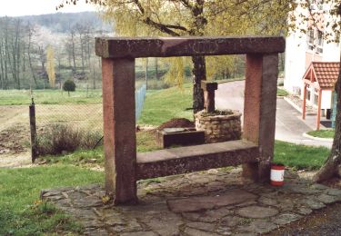
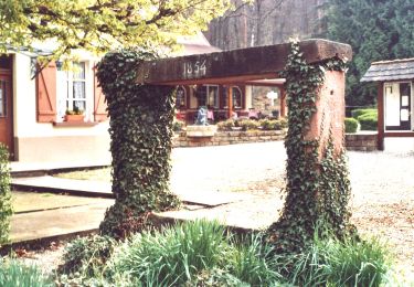
Trail Walking of 17.1 km to be discovered at Grand Est, Bas-Rhin, Drachenbronn-Birlenbach. This trail is proposed by LUTZMarc.

Description

resto Au cerf à Hundsbach. Excellent rapport qualité prix.
Penser à  réserver.

Elevation profile

Photos

Positioning

Country:
France
Region :
Grand Est
Department/Province :
Bas-Rhin
Municipality :
Drachenbronn-Birlenbach
Location:
Unknown
Start:(UTM)
418363 ; 5425432 (32U) N.

Trails nearby

Trail Mountain bike Cleebourg - Petite sortie VTT sympa secteur Wissembourg - Photo
Mountain bike
tracegps

Mountain bike

Medium
(1)
Cleebourg, Grand Est, Bas-Rhin, France
23 km | 32 km-effort
2h 30min
Yes
Trail On foot Climbach - Triangle vert - Photo
On foot
PRO

On foot

Easy
Climbach, Grand Est, Bas-Rhin, France
10.3 km | 15 km-effort
3h 24min
No
Trail On foot Cleebourg - Disque jaune - Photo
On foot
PRO

On foot

Medium
Cleebourg, Grand Est, Bas-Rhin, France
20 km | 27 km-effort
6h 13min
No
Trail On foot Merkwiller-Pechelbronn - Croix bleue - Photo
On foot
PRO

On foot

Easy
Merkwiller-Pechelbronn, Grand Est, Bas-Rhin, France
9 km | 11.9 km-effort
2h 42min
No
Trail On foot Soultz-sous-Forêts - Triangle bleu - Photo
On foot
PRO

On foot

Easy
Soultz-sous-Forêts, Grand Est, Bas-Rhin, France
6.1 km | 7.2 km-effort
1h 38min
No
Trail On foot Soultz-sous-Forêts - Anneau jaune - Photo
On foot
PRO

On foot

Easy
Soultz-sous-Forêts, Grand Est, Bas-Rhin, France
5.4 km | 7.8 km-effort
1h 45min
Yes
Trail On foot Soultz-sous-Forêts - Anneau vert2 - Photo
On foot
PRO

On foot

Easy
Soultz-sous-Forêts, Grand Est, Bas-Rhin, France
5.8 km | 7.7 km-effort
1h 45min
Yes
Trail Horseback riding Hunspach - SityTrail - Boucle Hunspach - Seebach - Photo
Horseback riding
GUIDE+

Horseback riding

Medium
(1)
Hunspach, Grand Est, Bas-Rhin, France
19.8 km | 23 km-effort
2h 53min
Yes
Trail Mountain bike Climbach - De Climbach au château du Hans Traap. - Photo
Mountain bike
Dutyrider

Mountain bike

Difficult
Climbach, Grand Est, Bas-Rhin, France
29 km | 37 km-effort
2h 26min
Yes


Close
My subscriptions