


Le mont des marseillais par pichauris de daniel

Coryphene
User
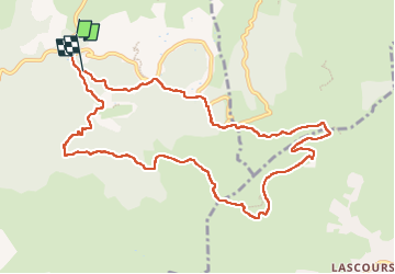

Length
11.7 km

Max alt
627 m

Uphill gradient
395 m
Km-Effort
16.9 km

Min alt
313 m

Downhill gradient
382 m
Boucle
No
Creation date :
2024-03-28 08:46:25.146
Updated on :
2024-03-28 16:51:25.223
3h50
Difficulty : Difficult

FREE GPS app for hiking
 SityTrail
IGN / Geographical institutes
SityTrail Plus
The world is yours!
About
Trail Walking of 11.7 km to be discovered at Provence-Alpes-Côte d'Azur, Bouches-du-Rhône, Allauch. This trail is proposed by Coryphene.
Positioning
Country:
France
Region :
Provence-Alpes-Côte d'Azur
Department/Province :
Bouches-du-Rhône
Municipality :
Allauch
Location:
Unknown
Start:(Dec)
Start:(UTM)
705556 ; 4805091 (31T) N.
Comments